 |
| From Hawaii 2013 |
Monday, January 21, 2013
Aloha from Hawaii
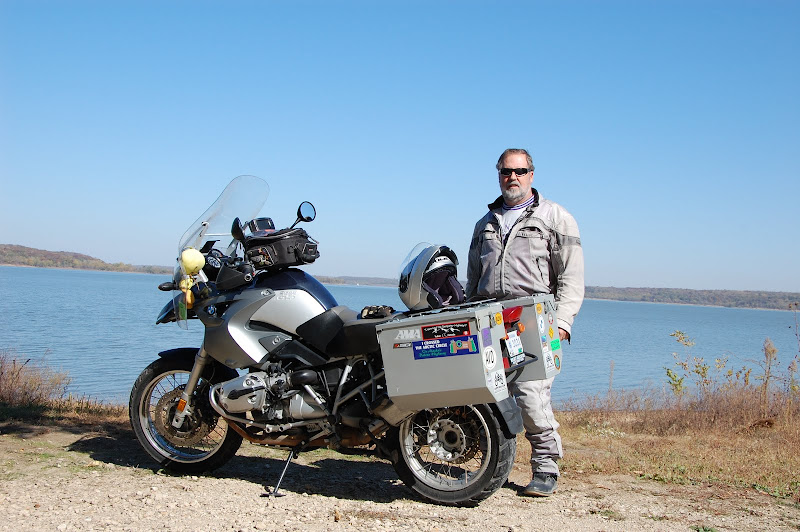
I have now ridden a motorcycle in all 50 states. Mary and flew to Hawaii and went on a cruise. While in Kauai I rented a 2013 Harley Heritage which was the first time to ride a Harley. I rode about 175 miles and added Hawaii to the other 49 states. Check this off my bucket list!
Wednesday, May 9, 2012
Travel to Georgia Mountain Rally
I got up at 6AM Thursday, May 3rd and went out to get the paper and the sky was very black in the north. I fixed breakfast and the clouds came rolling in here. It didn't look good for the start of my trip to Hiawassee, GA. I went ahead and got ready then looked at the radar and it appeared to be staying to the north around Kansas City. I went ahead and put on my rain gear and headed out. I zipped through Kansas City like I was the only one on the road as there was very light traffic. As I neared St Louis Lola wanted me to take I-64 so I did and it was a wise choice. Zipped through St Louis and I-64 comes out right at the Mississippi so over I went into Illinois. I stayed on I-64 the rest of the day going through Illinois, Indiana, and Kentucky. I stayed in Lexington, KY the first night as I had reservations. It was a 650 mile day. I tried to get reservations in Louisville but with the Kentucky Derby there that weekend the rates were from $150 to $450 a night. I stayed here for $67 in a Comfort Inn.
Friday was another good day of riding. Have now gone 936 miles. I made it to Knoxville, TN about noon then headed south and east on two lanes.
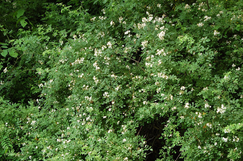
These flowering bushes grow along the roadway in both Tennessee and Georgia and are so intoxicating.
US129 was the road I traveled on the most and it turns into what is called the "Tail of the Dragon". That starts in Tennessee and ends in North Carolina with 318 curves in 11 miles.
Well it wasn't much fun today. It rained a little and then I got behind a long line of cars that that kept stopping on the curves and made it quite dangerous. As it turned out a semi tractor-trailer rig was the culprit. He would have to stop on the curves to clear traffic before he could make the turn. Dummy!!!!!!!!! Kill Boy was along the route taking pictures and I acquired two.
As you can tell I wasn't going all that fast. I made it to Hiawassee about 3:30 and checked into motel then went to the rally. Bob Diehl and I shared a room that was within walking distance to the rally. The others camped out with several hundred others. They didn't get rained on though.
On Saturday 6 of went for about a 150 miles through Georgia, South Carolina and North Carolina. Ken Krumm led the way and Bob Diehl, Lee Hunt, Walt Hoffman and Bob's friend from Florida followed. It was a nice ride with lots of curves.
Getting ready to ride!
After we got back we visited the vendors and told stories!
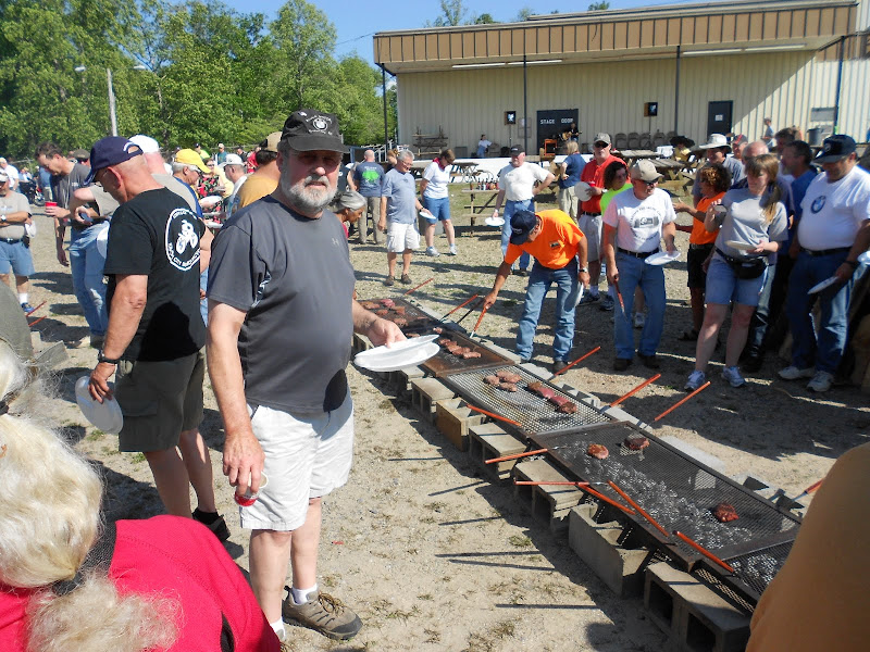
This rally always has a steak dinner on Saturday and you cook your own.
There were two big grills like this and it puts out lots of heat.
When it gets dark the big teepee will be lit. I didn't stay there to see it.
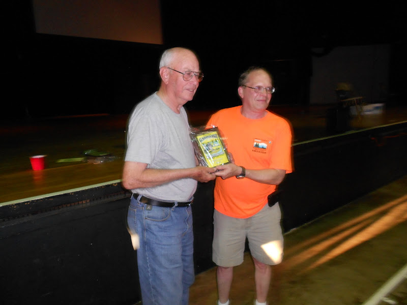
After we ate they gave away prizes but no one from Kansas won anything but Walt Hoffman from Manhattan got a plaque for the oldest male rider (80) and also for coming the greatest distance. He traveled over 1,200 miles getting there.
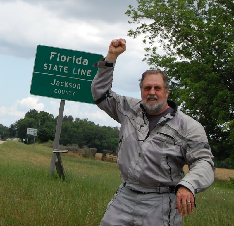
Sunday morning I headed south to Florida to pick up my 49th state. It was very hot and dry in southern Georgia. They were harvesting wheat in places. I stopped at a station for gas and the gnats were just horrific. I just filled with gas and left. They were in my hair and eyes and I just couldn't leave there fast enough. When I stopped to take the pictures of the Florida sign they were just as bad. I met hundreds of Harley's headed north coming from the Thunder Bay Rally in Panama City, FL.
My 49th State!!!!
Shortly after I took these pictures the sky darkened and the clouds rolled in. My first heavy rain of the trip. It was raining very hard and I pulled into a station for cover. The wind was blowing and the rain peppered down. It let up so I took off for Dothan, AL where I had a reservation at a Clarion Suites. Lola had trouble finding it and it was raining so hard I rode by it the first time. I had a free beer in the bar then bought three to take back to the room. I ordered in pizza and went to bed early. They had a great breakfast buffet and served me coffee and OJ all for free. What a deal! I hit the road about 6:30 and the temperatures remained cool all day. I had a period of rain in Alabama then late in the afternoon I stopped near Puducah, KY for fuel and called ahead for a reservation at the Comfort Suites in Mt Vernon, IL. Mary and I stayed there about 2 weeks before that and I had a free night then and used another free night. After fueling I only rode about two miles and the rain started. It rained hard and I had to pull off for a while. I rode out of the rain and dried off before I arrived at Mt Vernon. I checked in and they gave me coupons for 2 free drinks so I had two beers. I had a good stay there and headed for home the next morning at 7:30. It was the best day for riding yet. It started out cool and never got above 75 with only light winds. It just doesn't get much better than that for riding. Had some traffic as I was coming into St Louis over the river and staying on I-64. But once I made it though there it was smooth sailing. I stopped at Engle Motors in Kansas City for a head light bulb that burned out. Made it home about 2:30 PM and traveled 2,495 miles. I averaged 40mpg and spent $230 for fuel. It was a very pleasant trip and made it without any problems. I traveled though MO, IL, IN, KY, TN, GA, SC, NC, FL,and AL.
 |
| From 49th State |
 |
| From 49th State |
 |
| From 49th State |
 |
| From 49th State |
 |
| From 49th State |
 |
| From 49th State |
 |
| From 49th State |
 |
| From 49th State |
 |
| From 49th State |
 |
| From 49th State |
 |
| From 49th State |
 |
| From 49th State |
Sunday, May 6, 2012
49th State
Yesterday I made it to South Carolina and today to Florida for my 49th state on a motorcycle. I am staying in Dothan, Alabama tonight. The last 5 miles in a downpour!
|
| From 49th State |
|
| From 49th State |
Saturday, March 31, 2012
Statue of Liberty Tour part 1
This year the Heartland Rider's tour is to go to as many of the 26 Replica's of the Statue of Liberty in Kansas and take a picture. There are about 200 of these nationally. Here is a link that shows where they are: http://www.cheyennetroop101.org/liberty/
I took off yesterday afternoon on a beautiful spring day and headed northeast on K-4 to Atchison, then north on the K-7 traveling the Glacial Hills scenic byway. http://www.ksbyways.org/glacial_hills
I made it to Troy in Doniphan County for my first Boy Scout statue.
This is a very beautiful courthouse with a carved American Indian so take a look at it also while you are there.
I headed back south passing through Atchison and continued following the Glacial Byway. There are several neat homes along this stretch and a farmer that specializes in longhorn cattle. The road is narrow and hilly so no pictures. The fields are steep and have large terraces to hold the water and soil. They raise lots of corn and soybeans on this fertile land. I arrived in Leavenworth for the second statue which is by city hall.
There are over 200 of these replicas in 39 states in the U.S. and several of its possessions and territories. The project was the brainchild of Kansas City businessman, J.P. Whitaker, who was then Scout Commissioner of the Kansas City Area Council. The copper statues were manufactured by Friedley-Voshardt Co. (Chicago, IL) and purchased through the Kansas City Boy Scout office by those wanting one. All were erected in the early 1950's by Boy Scout troops and others to celebrate Scouting’s 40th anniversary theme, "Strengthen the Arm of Liberty."
The statues are approximately 8 1/2 feet tall without the base, constructed of sheet copper, weigh 290 pounds, and originally cost $350 plus freight.
I left Leavenworth heading west on K-92 highway. This a nice curvy highway that meanders southwest through farmland and goes through McLouth and Oskaloosa and comes out north of Meridan on K-4. This was a nice 200 mile ride with perfect weather.
Today I went to our state capitol and took a picture of the statue there. It is not as impressive as the other since they are still working on the capitol and may be for the rest of my life!
So I have 3 of the 26 statues in Kansas. We can earn extra points by going to other states. So stay tuned for more of these post this year.
I took off yesterday afternoon on a beautiful spring day and headed northeast on K-4 to Atchison, then north on the K-7 traveling the Glacial Hills scenic byway. http://www.ksbyways.org/glacial_hills
I made it to Troy in Doniphan County for my first Boy Scout statue.
 |
| From Boy Scouts Statue of Liberty |
 |
| From Boy Scouts Statue of Liberty |
 |
| From Boy Scouts Statue of Liberty |
 |
| From Boy Scouts Statue of Liberty |
 |
| From Boy Scouts Statue of Liberty |
 |
| From Boy Scouts Statue of Liberty |
 |
| From Boy Scouts Statue of Liberty |
The statues are approximately 8 1/2 feet tall without the base, constructed of sheet copper, weigh 290 pounds, and originally cost $350 plus freight.
I left Leavenworth heading west on K-92 highway. This a nice curvy highway that meanders southwest through farmland and goes through McLouth and Oskaloosa and comes out north of Meridan on K-4. This was a nice 200 mile ride with perfect weather.
Today I went to our state capitol and took a picture of the statue there. It is not as impressive as the other since they are still working on the capitol and may be for the rest of my life!
 |
| From Boy Scouts Statue of Liberty |
Sunday, October 23, 2011
Fall Ride
It is such a beautiful day today with light wind, blue skies and warm temperatures. I went for a walk this morning then decided to go for a motorcycle ride. I left about 11AM and went north east to Perry Lake. The trees and grasses look so pretty.
The water was smooth and some sail boats were catching what wind there was.
A Red Tail Hawk was cruising the airways overhead.
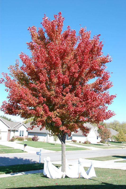
It was a great day for a ride and I rode about 100 miles. The prettiest tree was in our yard surrounded by ghosts.
 |
| From Fall ride 2011 |
 |
| From Fall ride 2011 |
 |
| From Fall ride 2011 |
 |
| From Fall ride 2011 |
 |
| From Fall ride 2011 |
 |
| From Fall ride 2011 |
 |
| From Fall ride 2011 |
 |
| From Fall ride 2011 |
Sunday, October 2, 2011
Rock Hunting Along the Smoky River
I headed west Thursday morning on I-70 to go rock hunting. As I entered I-70 at Auburn road the fall colors were worthy of a picture.
It was a beautiful fall morning but the weather forecast was for strong winds from the north. I hadn't gone far and the winds began to increase and by the time I arrived at Salina for fuel they were really blowing. At Salina I went west on old 40 highway which is K-140. I came to Brookville and I believe this is the old hotel made famous with the great fried chicken they used to serve. The Brookville Hotel is now in Abilene.
I came across this old farmstead and you wonder about the people that used to live there.
I found my first rocks at Mushroom Rock Park.
There was a windmill just over the hill.
Actually there were two!
More of the scenes and rocks.
This park is located south of a town that used to be Carneiro which means "sheep fold" and was founded in 1882.
I came to Kanopolis which is home to Ft Harker.
They also have a Drive-in theater, something you don't see much of anymore.
The Ft Harker museum was not open.
For more information about Ft Harker go here:
http://www.legendsofamerica.com/ks-fortharker.html
I ate lunch in Ellsworth home of Ft Ellworth.
http://www.santafetrailresearch.com/research/fort-ellsworth.html
I headed west out of Ellworth to near Wilson then came south to Holyrood. Some scenes along the way.
I came to Cheyenne Bottoms and rode around in there on the rough wash boarded roads.
There were quite a few birds but since the wind was so strong it was not a great day for viewing.
There was lots of dust in the air.
This dry wet land was where most of the dust was coming from.
There were some wildflowers growing.
I went to the Cheyenne Bottoms visitor center and spent a little time then headed into Great Bend as I a had a motel reservation there. After I got checked in I decided to look up a niece that lives in Great Bend. Their place was easy to find and Holly had just arrived home from work and her husband Bryan Gilliam was also there so I had a nice visit with them.
On Friday morning I awoke to a cool crisp fall day and no wind! I headed northwest on K-96 to Rush Center, then north to LaCrosse. I went west on K-4 through McCracken and turned north on K-147 towards Cedar Bluff State Park. The water was deep blue and not many trees around. The Smoky River flows into the lake.
I then came to my second "Rock" along the Smoky.
This is a BOD marker that marks the Butterfield Overland Dispatch a stage coach line that ran from Atchison to Denver.
http://www.santafetrailresearch.com/research/bod-dispatch.html
There are many markers along this trail and most are close to the Smoky River on the north side.
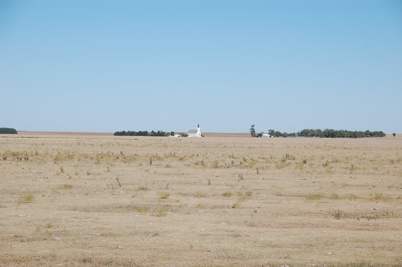
I went a few miles north on K-147 and found a good gravel road heading west. By looking at the map it should be 9 miles west to 283 hwy. Just before I get to the highway I see this church.
A closer view.
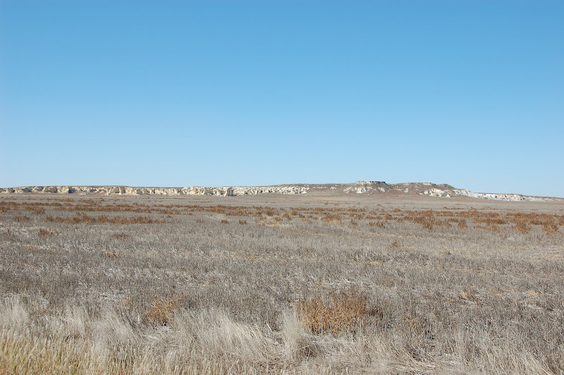
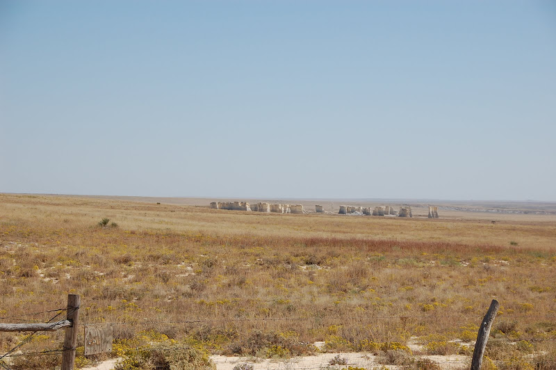
Now Castle rock is west and by looking at the map and some information I had I should go a couple miles north and find a sign pointing west. I didn't find it so I went south and came to the Smoky so I knew it had to be north. I went back to that church and there was a good road on the north side of it so I headed west. Now here's where things get a little sketchy. By looking at the map Castle Rock is half way between Collyer and Quinter, only about 15 miles south. So I am coming in from the east and start to see some rock formations.
They don't get close real fast and I wonder if I can get to them. This is the Badlands of Kansas!
I go as far west as I think I should then went south a mile or so then west again the first chance I get and come to this sign. Now this is the sign I thought I was going to find by the church.
So this is the road going in from the south.
I stopped here to check out the the trail ahead and decided to walk to the top. Good choice!
Deep ruts a steep incline. Four wheelers had been going up.
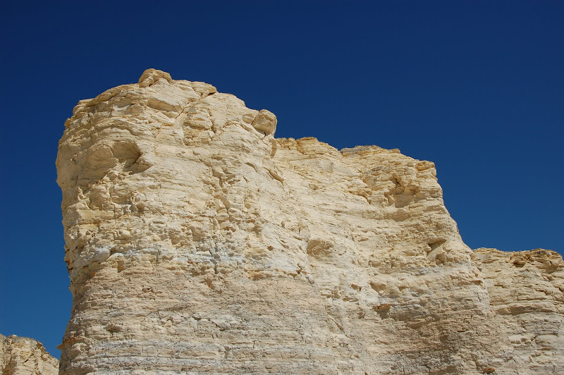
My third rock, Castle Rock from above.
View looking up.
I pushed the bike back down the hill a ways then took the trail to the left. It is not for the faint of heart. Had I walked down it a ways I probably wouldn't had ridden down but once you start you are committed. There were deep ruts and wash outs. One trail would end and you had to turn on the other to avoid complete wash outs. My bike sits high off the ground but I bottomed out several times. I made it down though.
And so did the bike!
The first pictures were taken from up there.
Castle Rock up close.
Prairie and Kansas Bad Lands.
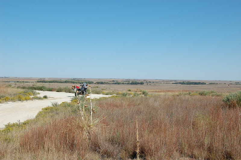
Castle Rock is on private property but people are allowed to come in. It is not very accessible except with off road vehicles. It was pretty steep getting back out of there. You sure wouldn't want to try this if the roads were wet. When I got to the sign where I came in I turned right and went about 6 or 7 miles west on a gravel road thinking I would come to pavement. Wrong! I came to a sign that said Quinter 15 miles north and guess what. Yep gravel. This was the view and if you look close you will see an elevator in the upper right of the picture 15 miles away.
I had one scary moment when I tried crossing from one vehicle track to another. There was about 6 inches of gravel and I had a firm grip on the handle bars but when I hit it at 35mph it was all I could do to keep it upright. Oh and did I say I was about out of gas? The light had been on a while and when I filled at Quinter I had about a half gallon left. The last three miles were paved. Yippee!
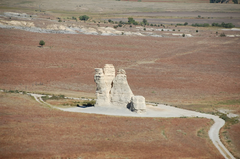
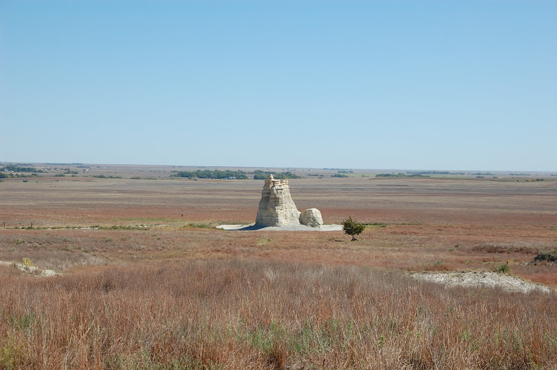
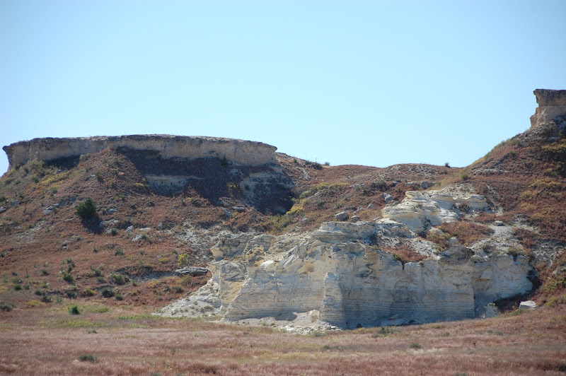
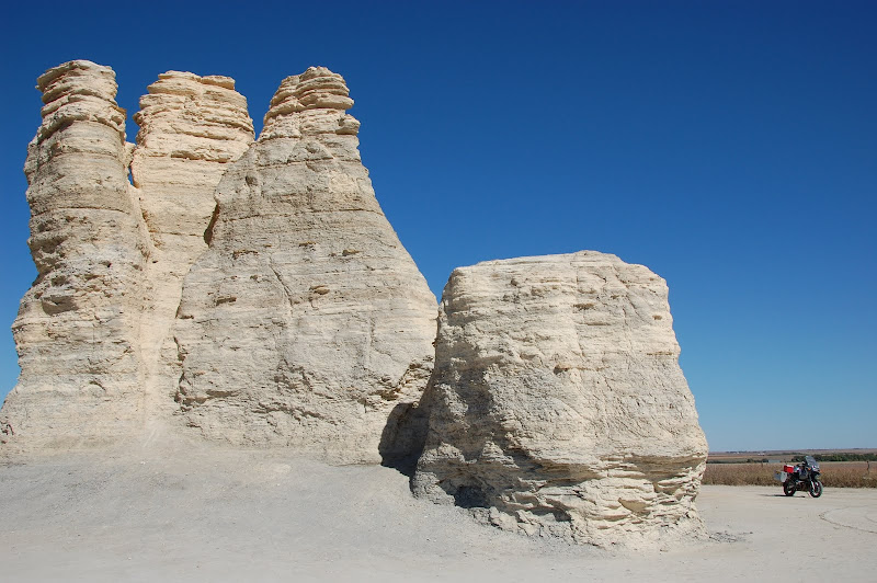
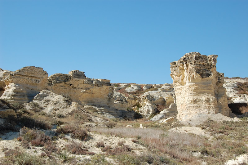
I went to a grocery and bought a banana and a Snickers and had lunch at 1:30. Then it was 35 miles west to Oakley and 25 miles south to the turn off to my 4th rock, Monument Rocks.
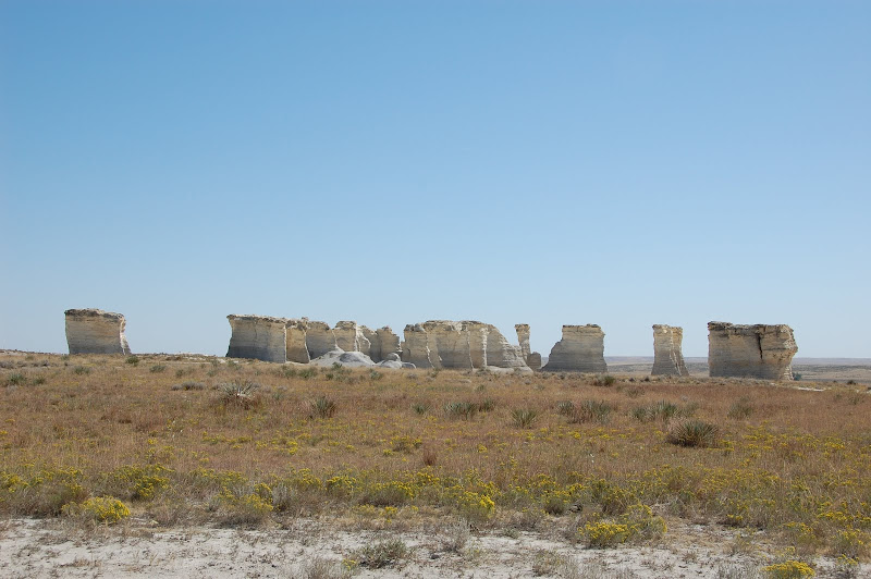
Castle and Monument are two of the 8 Wonders of Kansas. So here is my first view of Monument Rocks.
Me at Monument.
The "Eye of the Needle".
Other rock formations. "Charlie the Dog"
I am not sure what caused these? Maybe swallows nesting?
More rocks.
From highway 83.
I recommend Monument because you can get there with a car and only 7 miles of gravel. They are much more interesting too!
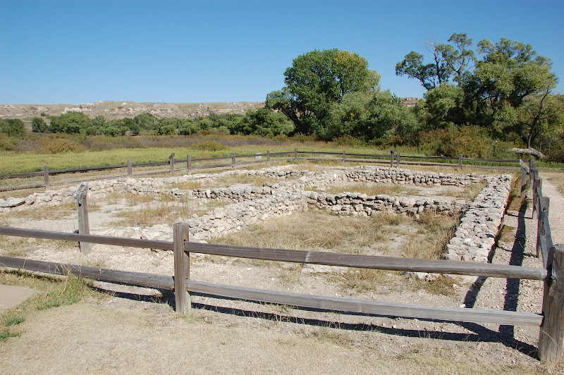
After getting back to the highway I had one more place I wanted to investigate so headed south towards Scott City. My 5th "rock" is a pueblo ruins. At Lake Scott there are the El Cuartelejo Pueblo Ruins and they are a National Historic Landmark. They date back to 1696.
Scott Lake
And finally my 6th rock is another BOD maker along US-83 just north of the Smoky River.
Smoky river in background. It is a small river.
Looks like I have a seal that needs replaced.
I stayed at Oakley Friday night and headed for home on Saturday arriving at noon. I was an interesting trip that I had contemplated for a couple of years. It was not easy with all the gravel roads but I am glad I completed it.
 |
| From |
 |
| From Mushroom, Castle, Monument Rocks |
 |
| From Mushroom, Castle, Monument Rocks |
 |
| From Mushroom, Castle, Monument Rocks |
 |
| From Mushroom, Castle, Monument Rocks |
 |
| From Mushroom, Castle, Monument Rocks |
 |
| From Mushroom, Castle, Monument Rocks |
 |
| From Mushroom, Castle, Monument Rocks |
 |
| From Mushroom, Castle, Monument Rocks |
 |
| From Mushroom, Castle, Monument Rocks |
 |
| From Mushroom, Castle, Monument Rocks |
 |
| From Mushroom, Castle, Monument Rocks |
 |
| From Mushroom, Castle, Monument Rocks |
 |
| From Mushroom, Castle, Monument Rocks |
 |
| From Mushroom, Castle, Monument Rocks |
 |
| From Mushroom, Castle, Monument Rocks |
http://www.legendsofamerica.com/ks-fortharker.html
I ate lunch in Ellsworth home of Ft Ellworth.
http://www.santafetrailresearch.com/research/fort-ellsworth.html
I headed west out of Ellworth to near Wilson then came south to Holyrood. Some scenes along the way.
 |
| From Mushroom, Castle, Monument Rocks |
 |
| From Mushroom, Castle, Monument Rocks |
 |
| From Mushroom, Castle, Monument Rocks |
 |
| From Mushroom, Castle, Monument Rocks |
 |
| From Mushroom, Castle, Monument Rocks |
 |
| From Mushroom, Castle, Monument Rocks |
 |
| From Mushroom, Castle, Monument Rocks |
 |
| From Mushroom, Castle, Monument Rocks |
 |
| From Mushroom, Castle, Monument Rocks |
On Friday morning I awoke to a cool crisp fall day and no wind! I headed northwest on K-96 to Rush Center, then north to LaCrosse. I went west on K-4 through McCracken and turned north on K-147 towards Cedar Bluff State Park. The water was deep blue and not many trees around. The Smoky River flows into the lake.
 |
| From Mushroom, Castle, Monument Rocks |
 |
| From Mushroom, Castle, Monument Rocks |
 |
| From Mushroom, Castle, Monument Rocks |
http://www.santafetrailresearch.com/research/bod-dispatch.html
There are many markers along this trail and most are close to the Smoky River on the north side.
I went a few miles north on K-147 and found a good gravel road heading west. By looking at the map it should be 9 miles west to 283 hwy. Just before I get to the highway I see this church.
 |
| From Mushroom, Castle, Monument Rocks |
 |
| From Mushroom, Castle, Monument Rocks |
 |
| From Mushroom, Castle, Monument Rocks |
 |
| From Mushroom, Castle, Monument Rocks |
 |
| From Mushroom, Castle, Monument Rocks |
 |
| From Mushroom, Castle, Monument Rocks |
 |
| From Mushroom, Castle, Monument Rocks |
 |
| From Mushroom, Castle, Monument Rocks |
 |
| From Mushroom, Castle, Monument Rocks |
 |
| From Mushroom, Castle, Monument Rocks |
 |
| From Mushroom, Castle, Monument Rocks |
 |
| From Mushroom, Castle, Monument Rocks |
 |
| From Mushroom, Castle, Monument Rocks |
 |
| From Mushroom, Castle, Monument Rocks |
 |
| From Mushroom, Castle, Monument Rocks |
 |
| From Mushroom, Castle, Monument Rocks |
 |
| From Mushroom, Castle, Monument Rocks |
 |
| From Mushroom, Castle, Monument Rocks |
 |
| From Mushroom, Castle, Monument Rocks |
 |
| From Mushroom, Castle, Monument Rocks |
 |
| From Mushroom, Castle, Monument Rocks |
 |
| From Mushroom, Castle, Monument Rocks |
 |
| From Mushroom, Castle, Monument Rocks |
 |
| From Mushroom, Castle, Monument Rocks |
 |
| From Mushroom, Castle, Monument Rocks |
 |
| From Mushroom, Castle, Monument Rocks |
 |
| From Mushroom, Castle, Monument Rocks |
 |
| From Mushroom, Castle, Monument Rocks |
 |
| From Mushroom, Castle, Monument Rocks |
I went to a grocery and bought a banana and a Snickers and had lunch at 1:30. Then it was 35 miles west to Oakley and 25 miles south to the turn off to my 4th rock, Monument Rocks.
 |
| From Mushroom, Castle, Monument Rocks |
 |
| From Mushroom, Castle, Monument Rocks |
 |
| From Mushroom, Castle, Monument Rocks |
 |
| From Mushroom, Castle, Monument Rocks |
 |
| From Mushroom, Castle, Monument Rocks |
 |
| From Mushroom, Castle, Monument Rocks |
 |
| From Mushroom, Castle, Monument Rocks |
 |
| From Mushroom, Castle, Monument Rocks |
 |
| From Mushroom, Castle, Monument Rocks |
 |
| From Mushroom, Castle, Monument Rocks |
 |
| From Mushroom, Castle, Monument Rocks |
 |
| From Mushroom, Castle, Monument Rocks |
 |
| From Mushroom, Castle, Monument Rocks |
 |
| From Mushroom, Castle, Monument Rocks |
 |
| From Mushroom, Castle, Monument Rocks |
 |
| From Mushroom, Castle, Monument Rocks |
 |
| From Mushroom, Castle, Monument Rocks |
 |
| From Mushroom, Castle, Monument Rocks |
 |
| From Mushroom, Castle, Monument Rocks |
 |
| From Mushroom, Castle, Monument Rocks |
 |
| From Mushroom, Castle, Monument Rocks |
After getting back to the highway I had one more place I wanted to investigate so headed south towards Scott City. My 5th "rock" is a pueblo ruins. At Lake Scott there are the El Cuartelejo Pueblo Ruins and they are a National Historic Landmark. They date back to 1696.
 |
| From Mushroom, Castle, Monument Rocks |
 |
| From Mushroom, Castle, Monument Rocks |
 |
| From Mushroom, Castle, Monument Rocks |
 |
| From Mushroom, Castle, Monument Rocks |
 |
| From Mushroom, Castle, Monument Rocks |
 |
| From Mushroom, Castle, Monument Rocks |
 |
| From Mushroom, Castle, Monument Rocks |
 |
| From Mushroom, Castle, Monument Rocks |
 |
| From Mushroom, Castle, Monument Rocks |
|
| From Mushroom, Castle, Monument Rocks |
 |
| From Mushroom, Castle, Monument Rocks |
Subscribe to:
Posts (Atom)